|
|
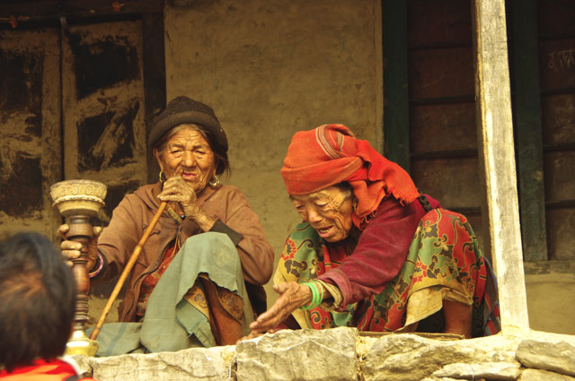
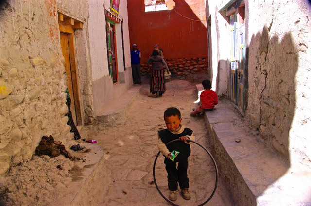
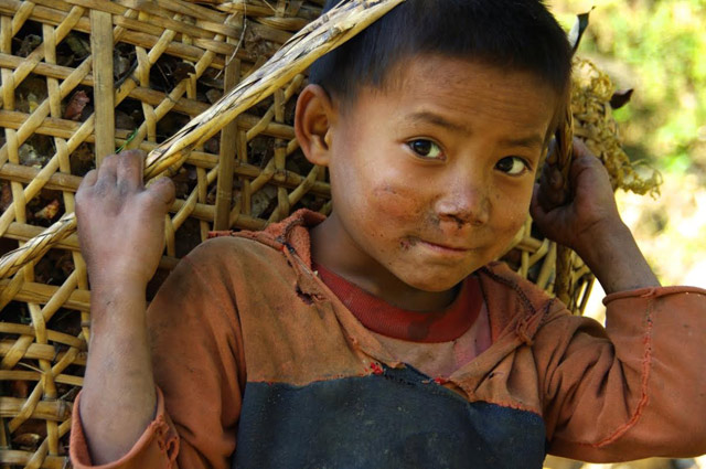
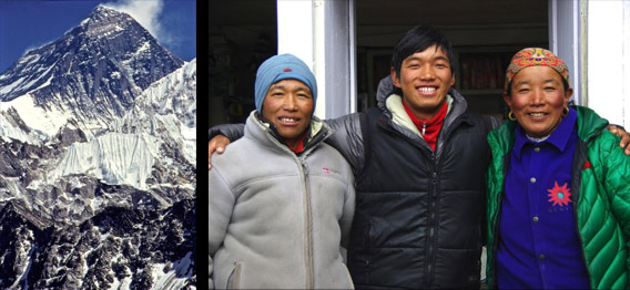
When I heard about the earthquake I became uncertain about posting a new trek. Talking with Nima Sherpa (from his tent in Kathmandu) reminded me of how every trek we do infuses many thousands of dollars into Gran, our porters village. They now need the work more than ever. In that sense, every trek is an aid trek. For Nima it means his three girls can go to school. Vishnu, our cook, says: if you no come, I die! I invite you to join Nima and I on these incredible journeys and help the people of Gran.
After The Earthquake
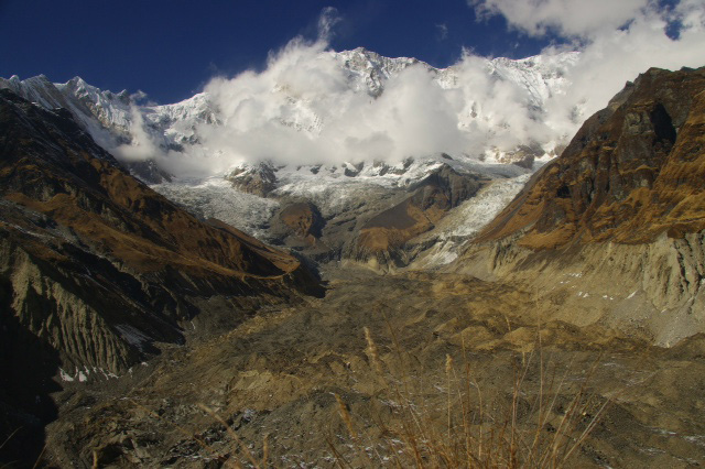
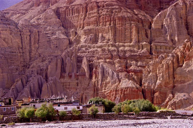
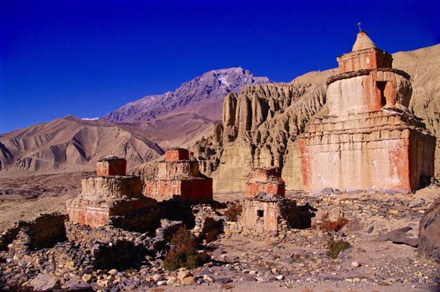
An astonishing high altitude desert, Tibetan culture, caves of the troglodytes, the walled city of Lo Manthang, crumbling fortresses of ancient warlords, 12th century cave paintings and an unbelievably blue sky, make a journey to Mustang one of daily amazement. To honour this fabled land, last fall we walked for twelve days north of the Annapurnas, before we began our 12 days (at $50 US a day permit fee), in the restricted territory of upper Mustang. The trek was wonderful but long, and our time in Mustang was too short. This year’s first option would fly in and out of Jomsom, trek through medieval villages below the Thorung La pass… for 4 days of pleasure and acclimatizing, then enter Mustang for 14 days. Last fall we were completely amazed climbing up to the Konchock Ling cave, painted in the twelfth century. With two more days we would be able to visit the Luri Gumba cave, also painted in the twelfth century. It would as well, enable a more satisfying circle trek.
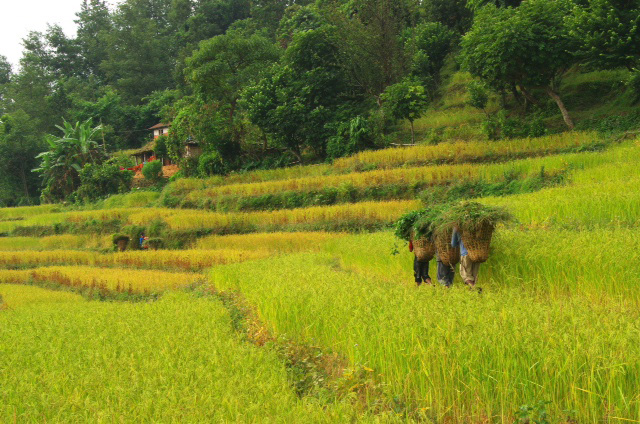
Option 2 would trek up the Kali Gandaki Valley to Mustang from Pokhara. Starting in intensely green rice paddies, and after languishing in hotsprings, we would climb through a steadily drying landscape. Walking into the rainshadow of the Annapurnas, the land turns arid, and we arrive in the dusty alleys of Kagbeni. Comparing the two options, I am drawn more to walking through the changes, watching the land turn into the desert that is the Mustang…than flying to Jomson and missing the incredible variety of Nepal. This version would take two more days of walking, but, as we fly only one way, it costs no more. The return to YVR would be October 25 rather than the 22nd. Which version we follow will depend on the leanings of those inquiring.
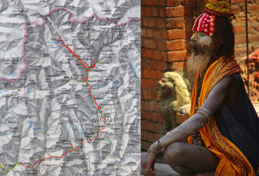
Itinerary 1 ~ Met by Nima and escorted to our hotel for lunch. ~ Explore the maze of Kathmandu. 1450m.
~ Bus to Pokhara, a balmy subtropical 800m.
~ Walk higher, or rest, or visit the temples at the pilgrimage site of Muktinath. ~ After a night in the subtropics we take a bus-ride to Birethanti...1025m. We walk up the new road for a few hours to the trailhead. An hour on the trail brings us to Tikedunga 1540m.
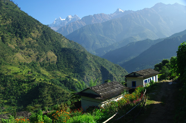
~ Our day begins with the infamous Ulleri staircase…all 420metres of it! Above it the trail angle lessens somewhat, we enter a somewhat cooler forest and the trail continues to climb to Ghorepani at 2850m. A long climb, but it gives us a panoramic view of Dhaulagiri 8167m. and the Kali Gandaki Valley, our walk for days ahead. ~ The bonus of Ghorepani is a pre-dawn climb of 200 metres up Poon Hill. The hill-top gives an incredible wrap around view of the sun rising on Dhaulagiri and the Annapurnas. After breakfast we walk downhill all day to the Kali Gandaki and the hotsprings of Tatopani, semi-tropical at 1190m. Besides the baths, Tatopani is famous for it’s chocolate cake and it’s orange groves.
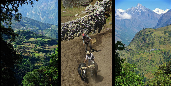
~ We follow the river as the mountains squeeze tight. This is considered the greatest defile on earth. Dhaulagiri and Annapurna, both over 8000m., are only 28 kilometres apart. The river between them is 2500m. We cross this axis in the canyon. There is a road up the valley, but we can stay on trails all the way. Despite the road, I am told there are still mule trains that grace the trails with their gay-coloured headdresses. We will try to walk to Kalopani, 2530m. where the roar of the river slows, and the great gravel beds begin. Whereas most of the trees today are deciduous, after lunch they begin changing to fir and pine and tomorrow they will dwindle to juniper and scrub as we enter the rainshadow of the Himalaya.
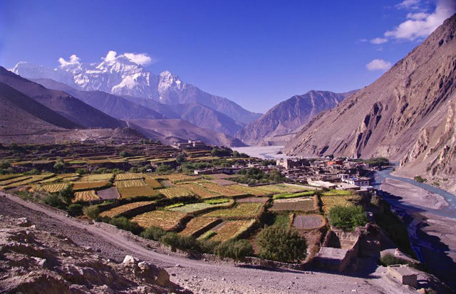
~ This is the land of the Thakali people who became the barons of the trade that flowed north and south from the lowlands to Tibet. Inns, now guest lodges, have large forecourts to handle the traders and their animals. When the Chinese closed the border to trade and the new road cut the numbers of trekkers, these large towns became partially ghost-town like. We will try to walk to Marpha, 2620m., the “apple pie capital” of the valley. The roofs are no longer peaked. The arid lands begin. Agriculture, including the large apple orchards, depends on irrigated water to survive. ~ Today we pass through Jomsom and continue to Kagbeni. The afternoon winds are a force, but fortunately are at our backs. The bandanas are coming out. Tomorrow the upper Mustang!
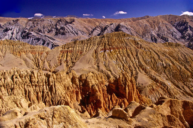
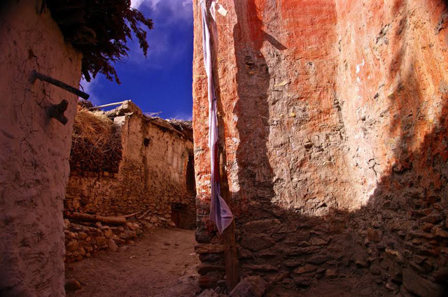
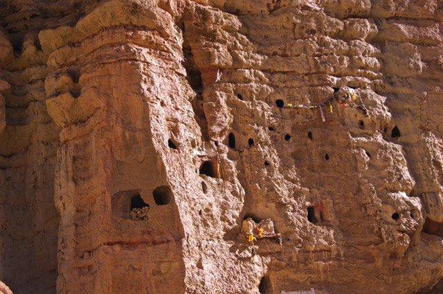
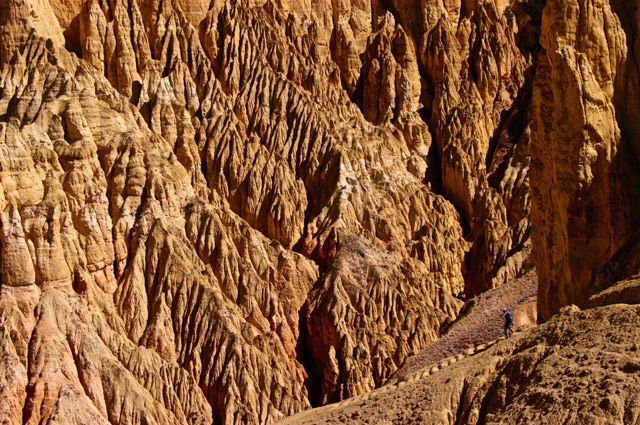
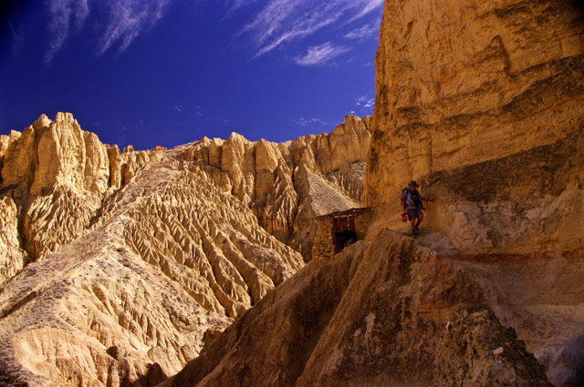
~ We pass the checkpoint and enter Upper Mustang, following the river braiding through the gravel beds. At Chusang , the canyon walls above us are pitted with caves. The cliffs are eroded into towers that loom over the valley like ancestral kings. Leaving the river we climb up to Chele. at 3050m., Flat roofs are stacked with firewood that form a windbreak for drying peppers, squash, corn and millet.
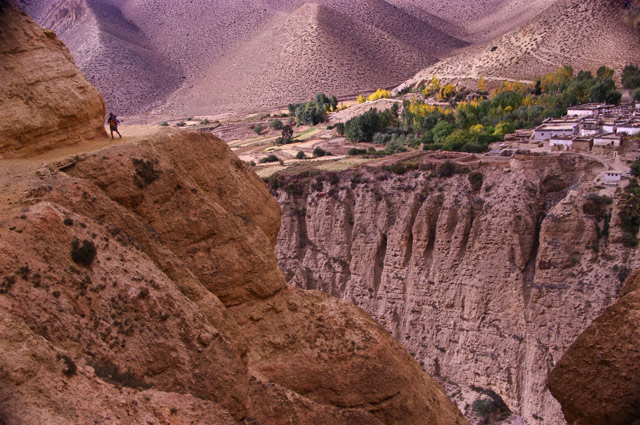
Leaving Samar we drop into a deep canyon and climb slowly up the other side only to come to another even deeper canyon. On the other side the trail climbs to a pass at 3850m. The land is vast and empty. Around a bend, far away, the two buildings of Shyanboche promise refuge as the wind begins to howl. They have a walled campsite and a welcome fire in a dining room. This is our first of many lodges that were once inns for the trade traffic. They all have several Tibetan styled dining rooms. We often have our choice. Across the road saddled horses were tied in front of a low mud building like a "wild west saloon".
~ Today we can look back and see how far we have come. The Annapurnas are all lined up and shrinking as we walk north. The jet stream wind strips spindrift off their summits... The sun pours down on yellow and purple canyons as we cross another short pass, 4105m. and drop down into the village of Ghami. at 3550m.
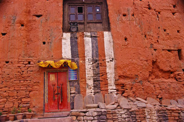
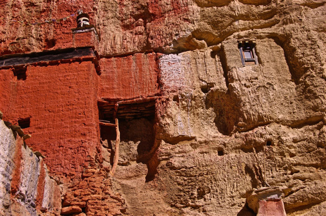
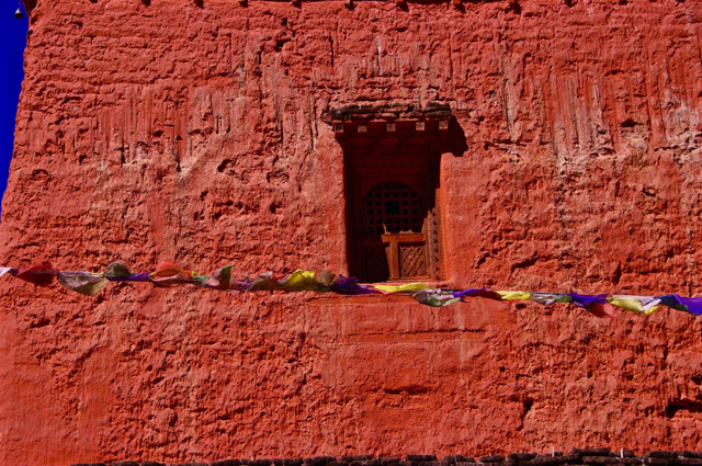
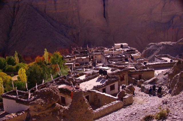
Ghami is medieval, as we’ll find all the villages to be. The walls are mudded white, the gompas mudded an intense red. We share the alleyways with all kinds of cattle. Their pies are collected and dried for fuel. We decide to walk half-days before the wind picks up. And two passes a day is a bit too much for most.
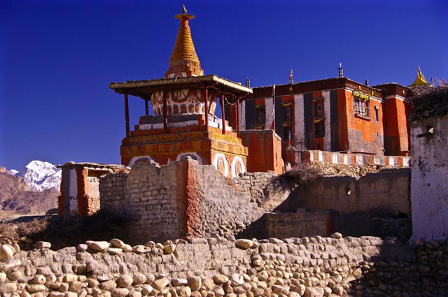
~ Tserang 3560m. - After a 4010m. pass we drop slowly down to a view of the red gompa (temple) and a huge stupa (monument), newly painted, with demons and dragons. Enough to scare off evil spirits from entering town. Although very devout Buddhists, there are many signs of animism and shamanism. Tserang has rows of poplar trees, the shade and the green and yellow, are a very welcome relief from the dry world outside.
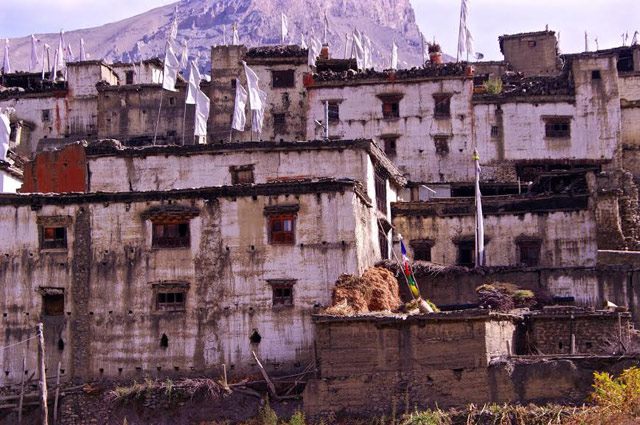
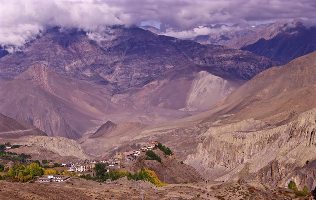
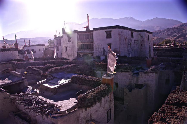
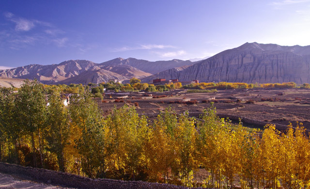
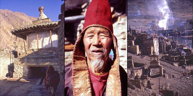
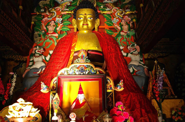
~ Lo Manthang 3810m. - Lo is a walled city built in the mid 14th century by a warlord who became the king. His four story palace dominates the city. When Mustang officially became part of Nepal the present king was demoted to a rajah, but for the Lobos (as they call themselves), he remained their leader. Now very old, he has moved to Kathmandu and the palace is deteriorating badly. Lo is an amazing place with endless alleys, three very large 12th century temples and countless chortens (monuments). It is very easy to spend a whole day exploring, or lost. Three hills rise outside of town with the ruins of a castle on one, a fortress on the tallest, and closest to town a sky burial site.
Sitting in one of several dining rooms in a very old inn, it is easy to imagine the traders, centuries ago, shouting and haggling, drinking strong brew and telling stories of distant lands.
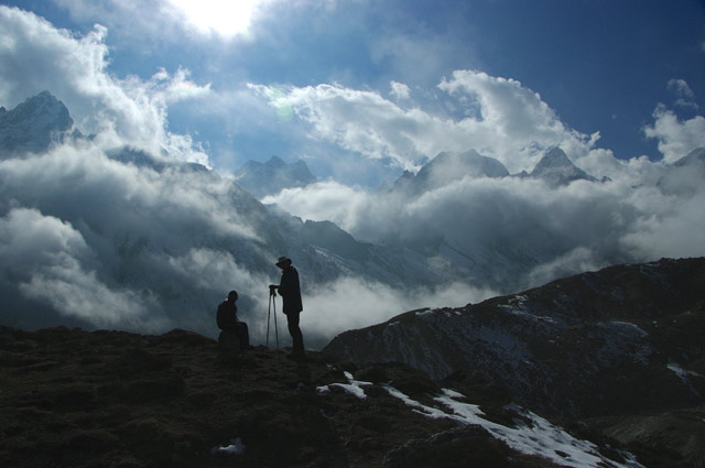
~ Today we visit Choser, Niphu Caves and the Kenchok Ling Grotto 3900-4300m. A most incredible day. It is possible to line up a jeep and guide to make all these sights possible in a long day. The Niphu cave is very accessible and has a staircase up to the first level. There are five levels with ladders to each. The levels are extensive with many chambers. They were built by the troglodytes one to two thousand years ago. Initially they were burial chambers but became dwellings as warfare intensified and the caves were easily defended. At least that is the theory. Much about them remains a mystery. Later when the Buddhists came the caves were ideal meditation cells.
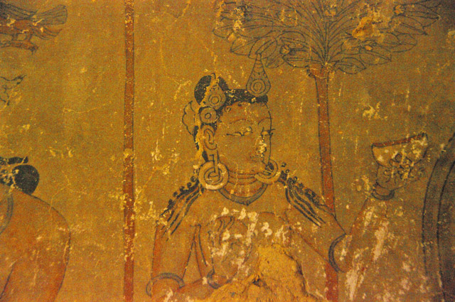
In the afternoon the jeep takes you part way up a canyon after picking up the key-bearer. It is a long climb up into progressively wilder eroded cliffsides. Along the ridge top the trail brings you to a cable. Lowering yourself to the ledge is very airy. But the ledge brings you to the most amazing grotto with walls painted in the 12th century. They are of a style that pre-dates all the Buddhist paintings I have seen in twenty-five years of visiting temples. It stretches your mind to imagine the painter at work over 900 years ago. One stays in a state of wonder all the way back to Lo Manthang.
~ Yara 3650m. - We head south and east and cross the Kali Gandhaki to Yara. Again caves everywhere.
~ Luri Gompa, Yara 3880m. We travel up valley to the caves of Luri Gompa. Here there is actually a temple inside a cave. The domed chamber, with a chorten in the middle was painted in the 12th century and is in much better condition than Kenchok Ling. In the afternoon we return to Yara.
~ Again we stay in Ghami
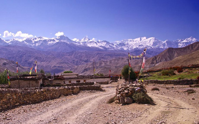
~ We hire a jeep to take us back to Kagbeni and on to Jomsom. ~ If all goes well we board our plane for a 30 minute flight to Pokhara. Although it is possible to continue flying on to Kathmandu, Pokhara is so soft and warm and the juice bars beckon and a boat ride on the lake is sublime. It’s just so nice to soak up the moisture. In the evening we’ll have a tip-giving party for the porters.
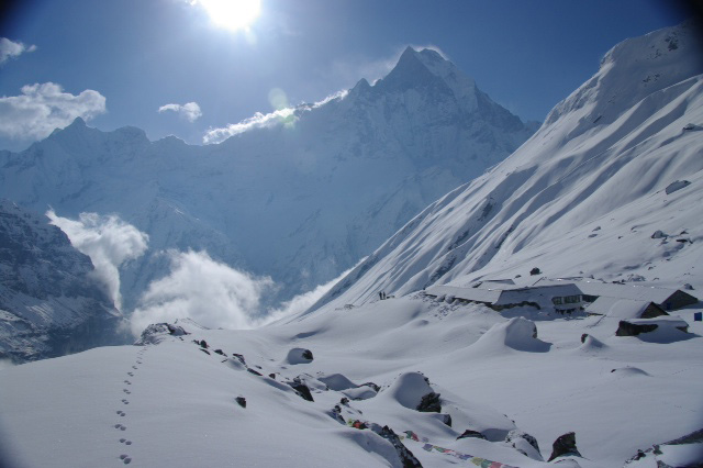
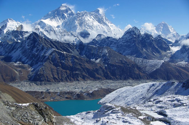
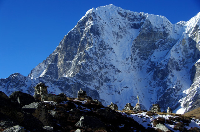
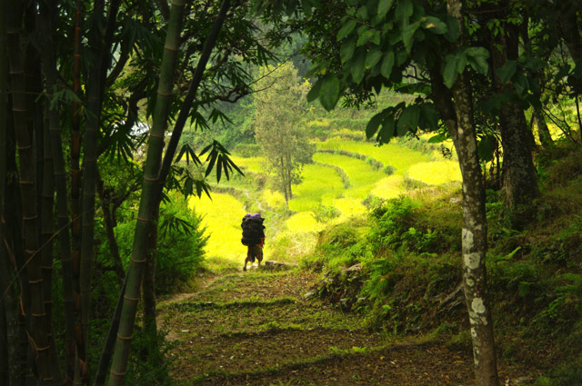
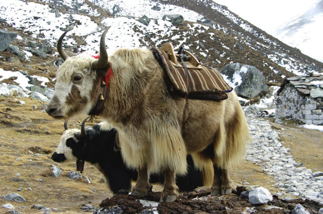
The mountains of the Khumbu are the most spectacular and dramatic on earth. A sea of 6000m. peaks swirl around the feet of the giants: Everest, Lhotse and Cho Oyu. Yak bells, the horns of monks, the hospitality of the Sherpa people amidst these mountains of an unimaginable scale, make a journey here a deeply moving experience. But all the groups I have travelled with agree, our week of walking through the villages and forests of the middle hills is what they remember most: sitting by a family's fire, by a river in the hills, with our hearts full to the brim.
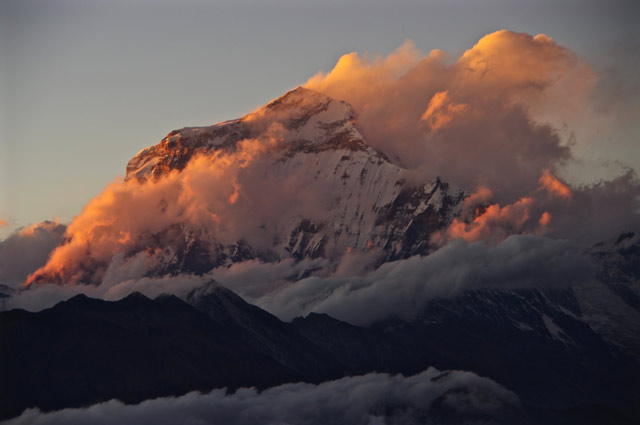
We merge relunctantly with the crowds at Lukla, and travel with them for two days to Namche Bazaar. While the horde marches off to Everest Base camp we turn north into the beautiful Gokyo Valley. On top of Gokyo Ri we are surrounded by four 8000m. peaks and their true majesty is revealed. Walking to glacial lakes opens up the most amazing vistas. Walking the trail to Pangboche is an airy delight. At the Tengboche monastery we watch plumes of cloud sail off from Everest’s summit. It is all so very overwhelming.
Itinerary ~ settling in to your hotel, getting your bearings in the bazaar, changing money.
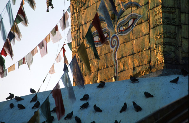
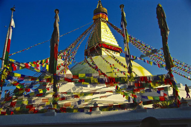
~ Exploring Kathmandu ~ Dawn over Kathmandu from the hill-top Buddhist temple Swayambunath.
~ Bus to Shivalaya - 1750m. If it’s clear we’ll have our first views of the Himalaya. ~ Over the pass to Bhandar - 2150m. Entering the land of the Buddhist Sherpas. ~ Sete - 2575m. the morning walk drops from Bhandar to Kenja at 1570m. then begins the long climb to the Lamjura La. Sete is halfway up. Fantastic sunsets from an ancient crumbling monastery.
~ Junbesi - 2675m. After lunch at the pass -3530m. we begin the descent to Junbesi. Inhabited by Sherpas for centuries, the land is rich and pastoral. The people are also rich in culture and hospitality. ~ Junbesi. This is a rest / explore / washing day. Thubten Choling, the monastery home to 500 Tibetan monks and nuns is 90 minutes up the valley.
~ Nuntala - 2250m. On a clear morning, just around the ridge-end from Junbesi, we have our first view of the enormous Himalayan peaks. After lunch we cross the Trashindo La, a small pass and enter the Dudh Kosi watershed. Nuntala is halfway down the long descent to the river that drains all the water of Everest and the Khumbu.
~ Bupsa - 2300m. Having crossed the Dudh Kosi we turn north and begin our climb to the Khumbu.
~ Surke - 2290m. Our night in this quiet riverside village is the last before we merge with the “crowds” who have flown into Lukla. Clean, pressed, cologned and hell-bent for Base Camp. Those who have walked in realize how precious those days were. ~ Phakding - 2800m. a large Sherpa/ hotel town straddling the river. ~ Namche Bazaar - 3450m. It’s a long hill up to Namche., the commercial center of the Khumbu Sherpas. Long the mecca of mountaineers and hikers, one feels great satisfaction in having arrived here on foot, particularly if you have walked from Shivalaya.
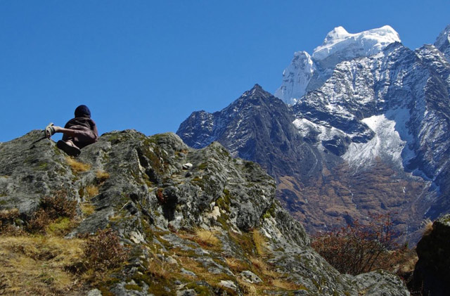
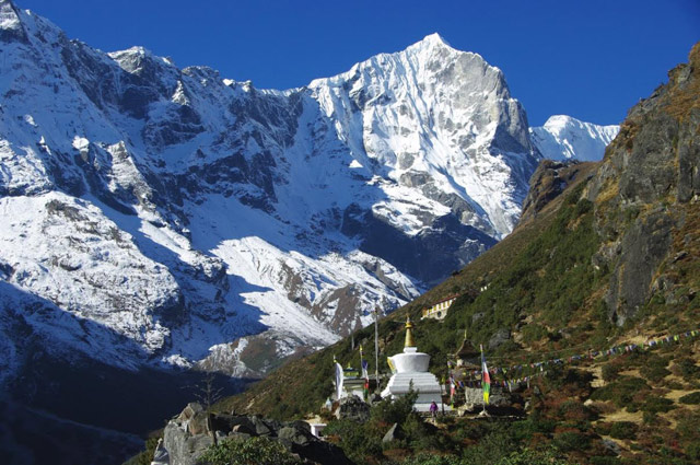
~ Another night is necessary to acclimatize. It is helped greatly by walking higher still. As the area around Namche is stunning, it’s a pleasure more than a duty. Above Namche the world opens up and you are surrounded by ice peaks with Ama Dablam and Everest crowning the head of the valley. As our hours of trekking are shorter at high altitude, these afternoon hikes become a regular feature. Besides increasing your pleasure, they greatly assist your acclimatization. You get to sleep “low” every night! ~ Mong La - 4000m. This little hamlet perched on the side of Mt.Khumbila is the gateway to the Gokyo valley.
~ Dole - 4100m. Camping at the Yeti Inn! Kangtega behind, towers over us. Cho Oyu 8153m. dominates the head of the valley. ~ Machermo - 4400m. On the afternoon walk, 5000m. and a view of Everest, (which we have lost since being in the Gokyo Valley), are both possible. The Valley is beautiful from every height… there is no mandatory height to reach on these afternoon outings…if it isn’t a pleasure, something isn’t working.
~ Gokyo - 4750m. The last settlement in the Valley. Cho Oyu is Huge!
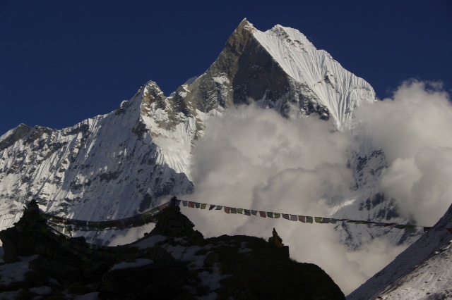
~ Gokyo - An early morning ascent of Gokyo Ri, 5350m. offers what many, myself included, consider to be one of the world’s greatest views, and the best of Everest. Cho Oyu, Gyanchkung, Everest, Nuptse, Lhotse and Makalu are like tall ships sailing through hundreds of tiny 6000m. dinghies.
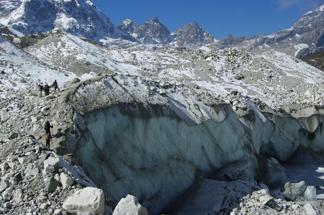
~ Gokyo - The nights are cold but, oh, the sun is so nice in the days. Walking up the valley along the moraines of the Ngozumba Glacier, (the longest in the Nepal Himalaya), to Fourth Lake, Cho Oyu keeps growing. At Fifth Lake, suddenly a valley opens up to the east and there is ALL of Everest rising up above the Changri La.
~ Phortse - 3900m. We turn back down the valley and cross below the snout of the glacier to the east side trail, which gives even better views of the valley peaks. ~ Old Pangboche - 4000m. The trail from Phortse is one of the world’s best, winding like a staircase in space to old Pangboche. The Everest Highway is down below, old Pangboche sits quietly in it’s grove of juniper trees by the Khumbu’s oldest gompa (Buddhist temple).
~ Tengboche - -3800m. Many years ago I went uphill from Pangboche and found myself on top of a pinnacle at 5200m. and the views were overwhelming. I called it Taboche Ri. It is an unsung treasure. and you can still walk to Tengboche the same day. Tengboche is the principal monastery in the Khumbu, spectacularly located, straddling a high ridge at the junction of the upper Khumbu valleys.
~ Namche - Our last night at altitude. There are discos, bakeries and pool halls if you are so inclined. But outside there is the moon and the monk's last horn of the day.
~ And down to Lukla - down out of the high country. And if the morning is clear, the planes will fly and, “Oh my God! What a take off! What a flight!” In fourty-five minutes the Khumbu is gone and you’re on the streets of Kathmandu! It seems even more bizarre after weeks in the peace of the mountains. Most of us seem to eat and shop a lot! And we have a party with Nima and then we are gone. Often the next couple of months are spent daydreaming. It seems impossible to explain or describe it. ASIA! You begin to dream of going again.
Home | Welcome | Schedule | Trekking | Trekking Style | Business Langtang | Everest | Annapurna | Climbing Expeditions | Recommended Reading Equipment List, Fine Print and Basic Nepalese
Moon Mountain Adventures
web site design: Tom Carter and Anita Roy
Moon Mountain Adventures : Trekking in Nepal : Budget trekking expeditions into the Nepal Himalaya, off-route exploration of Everest, Annapurna, Langtang. high altitude travel, trekking, Nepal, Himalaya, tour, guide, Sherpa, mountain, culture, adventure, Kathmandu, Annapurna, Everest, Khumbu, Langtang, personal, package, Canadian, experience, hiking, mountains, adventure, travel, Kathmandu, Sherpa guide, Annapurna, Langtang, Mount Everest, high mountain valleys, group camp trekking, lodges, trekkers, camping groups, explore off-route villages, Everest.Parksville, Nanaimo, Qualicum, Arrowsmith, British Columbia, B.C.Moon Mountain Adventures: Parksville, Qualicum, Nanaimo, Victoria, Vancouver, Canada |
|


.jpg)
.jpg)